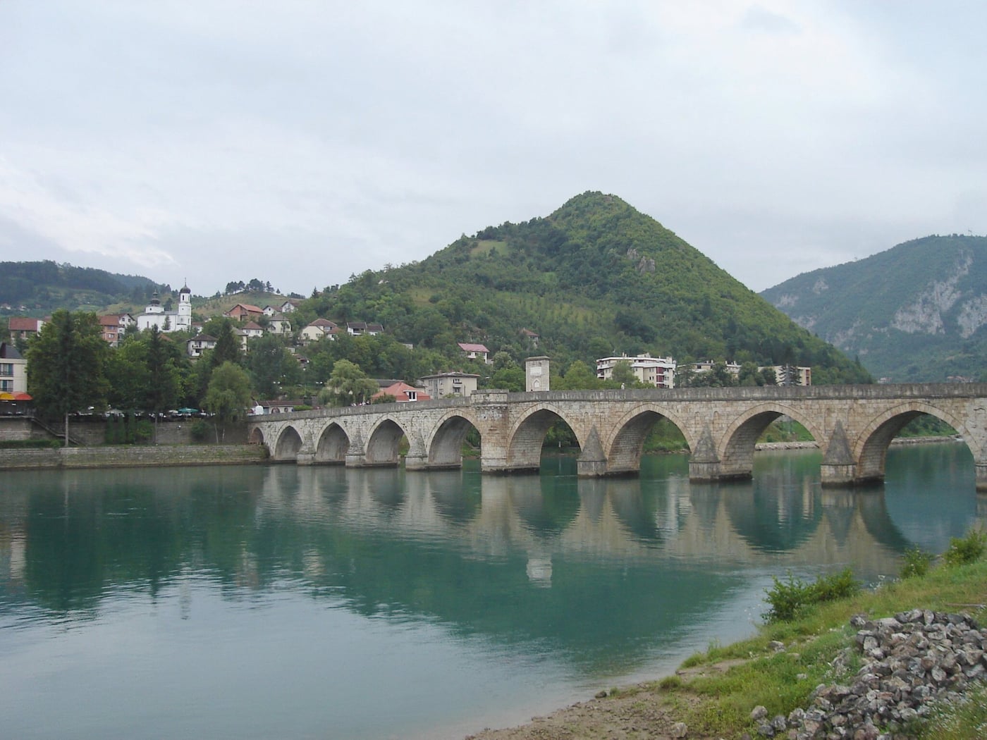
Stone Mehmed Paša Sokolović Bridge over the Drina in Višegrad

✦ EASTERN BOSNIA · CITIES · HISTORY

Višegrad.

The Drina, the bridge and Andrić's stories.

RECOMMENDED1 dayBEST TIMEApril – OctoberIDEAL FORHistory, literature and a quieter trip

Photograph: Cornelius Bechtler · CC BY-SA 3.0 · Source and modifications

✦ FIRST VISIT

Višegrad is a relaxed day trip. Give most of your time to the Mehmed Pasha Sokolović Bridge and the Drina riverfront, then visit Andrićgrad before lunch or in late afternoon.

✦ Why it is worth visiting

The Drina, the bridge and Andrić's stories.

Višegrad is inseparable from the Drina and the Mehmed Paša Sokolović Bridge, while the town's quiet pace suits a day trip through eastern Bosnia.

01DON'T MISS

What to visit

  1. ✦Mehmed Paša Sokolović Bridge

    The stone bridge over the Drina is the central stop. Cross on foot, then look back from the bank to see the line of arches. A local guided walk can connect this stop with Ivo Andrić’s story.

    LocationVišegrad
    Open in Google Maps ↗

    Source: Turistička organizacija Višegrad ↗

  2. ✦Drina

    For a first visit, walk along the river between the bridge views and Andrićgrad. For a cruise, confirm the boarding point, duration and return with the operator. Do not treat a sightseeing boat as a regular urban service without checking.

    LocationVišegrad
    Open in Google Maps ↗

    Source: Turistička organizacija Višegrad ↗

  3. ✦Andrićgrad

    Andrićgrad is a modern cultural and visitor complex at the Rzav–Drina confluence, not a preserved medieval quarter. Explore its squares and streets after the bridge and pause here. Check which exhibitions or events are open on your date.

    LocationVišegrad
    Open in Google Maps ↗

    Source: Turistička organizacija Višegrad ↗

  4. ✦Viewpoints above town

    Ask the tourist office for a currently open, marked viewpoint route suited to your fitness and vehicle. The map link leads to tourist information, not an unverified trail. With only a few hours, stay with the views from the town’s riverfront.

    LocationVišegrad
    Open in Google Maps ↗

    Source: Turistička organizacija Višegrad ↗

  5. ✦Drive along the Drina

    Distinguish a short boat ride near town from a longer river or road excursion. Before booking, request the exact route, total duration and return point. On a road trip, stop for photographs only where parking is permitted, never on blind bends.

    LocationVišegrad
    Open in Google Maps ↗

    Source: Turistička organizacija Višegrad ↗

02PRACTICAL

Getting there

Begin at the Mehmed Paša Sokolović Bridge and walk along the Drina toward Andrićgrad at the Rzav confluence. Arrange a boat trip separately; departures depend on the operator and river conditions.

How long to allow

3–4 hours for the bridge, Andrićgrad and lunch. A longer Drina cruise or a trip to Dobrun needs extra time; neither fits automatically into a short stop.

Suggested sightseeing time; adjust travel and breaks to your own pace.
03TASTE THE REGION

What to try

Fish, grilled dishes and home-style cuisine by the Drina.

✦ A simple visit plan

Morning

Mehmed Pasha Sokolović Bridge and a walk by the Drina

Midday

Andrićgrad, lunch and the town centre

Afternoon

A viewpoint or confirmed boat trip when conditions allow

✦ Parking and getting around

Use signed parking near the centre or the approach to Andrićgrad. The bridge is a walking destination, not a parking place. For coaches, larger vehicles or a boat connection, ask the tourist office to confirm the arrival point in advance.

Access and further information: Turistička organizacija Višegrad ↗

Open in Google Maps ↗

✦ Places to visit nearby

Nearby.

DobrunDrinaRudoTara
Open in Google Maps ↗

✦ Practical notes

  • The bridge is a UNESCO site; protect its stone surfaces and leave no rubbish.
  • Book boat trips and confirm prices with a reliable local operator.
  • The riverfront can feel noticeably cooler than the town centre.

✦ What to try

Fish, grilled dishes and home-style cuisine by the Drina.

← See all destinations

This information is a planning guide. For mountains, parks and seasonal locations, check current conditions before you leave.